Understanding Geospatial Analytics – The Art Of Mapping
Geospatial Analytics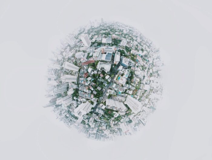
August, 2021
What is geospatial analytics?
Geospatial Analytics refers to the accumulation, assimilation, and representation of geographic data. It makes use of geographical coordinate systems and satellite imagery in creating visual models of geographic locations. They are used to draw maps, generate graphs, or display statistics of a region. Without the use of geospatial analytics, visualization would become difficult. The worldwide GIS market is expected to exceed US$13.6 billion by 2027. Around 36% of mid-sized and large companies will deploy their location intelligence software by the year 2025.
Some analytic tools also input time data into their algorithm. This adds another parameter to the equation and can enhance the model further. With geospatial analytics, we can perform a wholesome study of the site. A complete report of any event that occurs here can be generated very quickly. It is a more efficient way of data representation.
Large sheets of textual data can be quite cumbersome and mundane to go through. Instead, geospatial analytics portrays data in the form of illustrated graphs and well-labeled maps. This makes any critical data clearly visible. Geospatial data can be used in real-time to find discrepancies and changes in a certain location.
The importance of geospatial analytics
Reports constructed in rows and columns are very fast and contain mountains of data bunched up in a single space. Scanning through this for relevant information can be time-consuming and inefficient. Geospatial analytics provides maps that make it easier to record the appropriate information.
Images are the solution
The geospatial image creates a simulated image of the Earth or any specific region on the Earth. This helps envision future risks and devise contingency plans to avoid them. The imaging information is derived from satellites with time and location stamps. Bitmaps and vector images are then produced from this information.
These maps are predominantly used to analyze natural phenomena like weather and disaster management. They can also be used on construction sites for build planning. Geospatial imagery analytics can be used in 5 major sectors:
- Mapping and Imagery: Using geospatial image analysis, detailed maps can be automatically generated. Insights of a region can be clearly identified, and future planning of the area can be done.
- Positioning Systems: The famous Global Positioning System (GPS) uses data from geospatial imagery to find a location and the shortest path to it.
- Surface Analysis: Geospatial analytics provides imagery that can be used to get data on the surface of a given region. With this information, we can decide whether the better use of the land would be agricultural or industrial.
- Defense: The military can use this data to develop strategic advances and pinpoint enemy locations. They can also scope out the environment to get the best vantage points.
How is it better?
Geospatial data analytics has a wide range of benefits. Understanding the terrain, weather, or any other factor of a region can help any organization. But the representation of the report is where geospatial data analytics excels. Some benefits of geospatial data are listed below:
- Accurate Prediction: Geospatial data analysis can draw real-time images. They also depict any changes in the environment. This gives the means to accurately form predictions about the future conditions of an area. Coupled with machine learning, this technique can analyze patterns and automatically design graphs, statistics, and even maps based on the predictions.
- Vibrant Depictions: While color-coding graphs may seem like a waste of time and resources, it creates an easy-to-read report. Ultimately, graphs save time. Valuable insights that may have been overlooked using conventional analysis and report rendering methods are clearly visible in these maps.
- Pinpoint Parameters: Rows and columns are great. But with the reports generated from geospatial analytics, the entire graph doesn’t have to be scanned to find an error or solution. They can be directly selected due to the separate visualization.
Geospatial analytics applications in 2021
Geospatial data has a wide range of use-cases. Some areas where it exhibits impact:
- Weather: Meteorologists heavily rely on geospatial analytics to detect storms and natural disasters. By analyzing the pattern of the storms, we can predict their direction and impact rate. With warning and proper procedure, countless human lives can be saved. Other weather conditions can also be predicted.
- Urbanization: Urbanization plans can greatly benefit from information of geospatial data analysis. Everything needs a proper location to work most efficiently. Using geospatial data analysis, we can get a clear picture of the most beneficial locations to construct structures.
- Telecommunication: Many technologies use location-based services to make our lives easier. GPS, messaging, and now, even search engines use location to provide better searches based on our location. Geospatial data of a computer IP or a cell phone number make these technologies possible.
- Natural Resource: Geospatial analytics is great at finding natural resources. A single satellite in space can send images of the surface below. A geospatial analytics algorithm can then inspect the image and generate a report on the likelihood of finding a resource. This is a better financial and time-wise solution since an exploration team’s labor cost and time are saved.
- Healthcare Industry: Many countries used geospatial data analysis for contact tracing and identifying potential threats from emerging variants. On various levels, location-based apps are being used to prevent the spread of the virus.
Who can benefit from it?
Whether you’re a business looking for customers or want the perfect location to build your house, you have a use for geospatial data. Here are some businesses that can use it to their advantage:
- Tourism and Travel: This industry is location-centric. With proper geospatial information, a GIS service company can provide their customers with information on sight-seeing locations, hotels, and even weather conditions at different times of the year.
- Energy: Location is key even in this sector. Finding the best region can increase power generation manyfold. This field can sometimes be hazardous. So, it is essential to keep it away from residential areas to reduce the loss of human life. Geospatial data analysis can give you insights into the most advantageous location.
- Media: If effectively used, the media sector can profit from locating their customers and providing relevant recommendations to them, as does YouTube, for example.
- Construction and Housing: Identifying a new site for building a new project or planning the indoors, wayfinding, and allocating spaces can be achieved using geospatial data analysis. A GIS service company with the information of the location provides insights for better decision-making.
- Government and Public Services: Identifying the natural disasters and creating a disaster management plan to reduce the risk using satellite imagery.
The future of geospatial analytics
Any sector can benefit from understanding and correctly using geospatial analytics. Not only is it a more cost-effective option, but it can also reel in customers by using proper location-based marketing techniques. With the increasing number of GIS service companies, the location-based solution has become more accessible and cost-efficient. By the year 2025, it is predicted that around 40% of IoT devices will have the ability to share their locations. Better connectivity with technologies such as 5G, the location-based information will become more popular in decision making and identifying business opportunities.
Related Tags
Author
SGA Knowledge Team